 Open Access
ARTICLE
GIS-Based Identification of Flood Risk Zone in a Rural Municipality Using Fuzzy Analytical Hierarchy Process (FAHP)
1 Civil Engineering Department, Romblon State University, Odiongan, Romblon, 5505, Philippines
2 Research, Development, and Innovation Unit, Romblon State University, Odiongan, Romblon, 5505, Philippines
* Corresponding Author: Jerome Gacu. Email:
Revue Internationale de Géomatique 2024, 33, 295-320. https://doi.org/10.32604/rig.2024.055085
Received 16 June 2024; Accepted 09 August 2024; Issue published 03 September 2024
Abstract
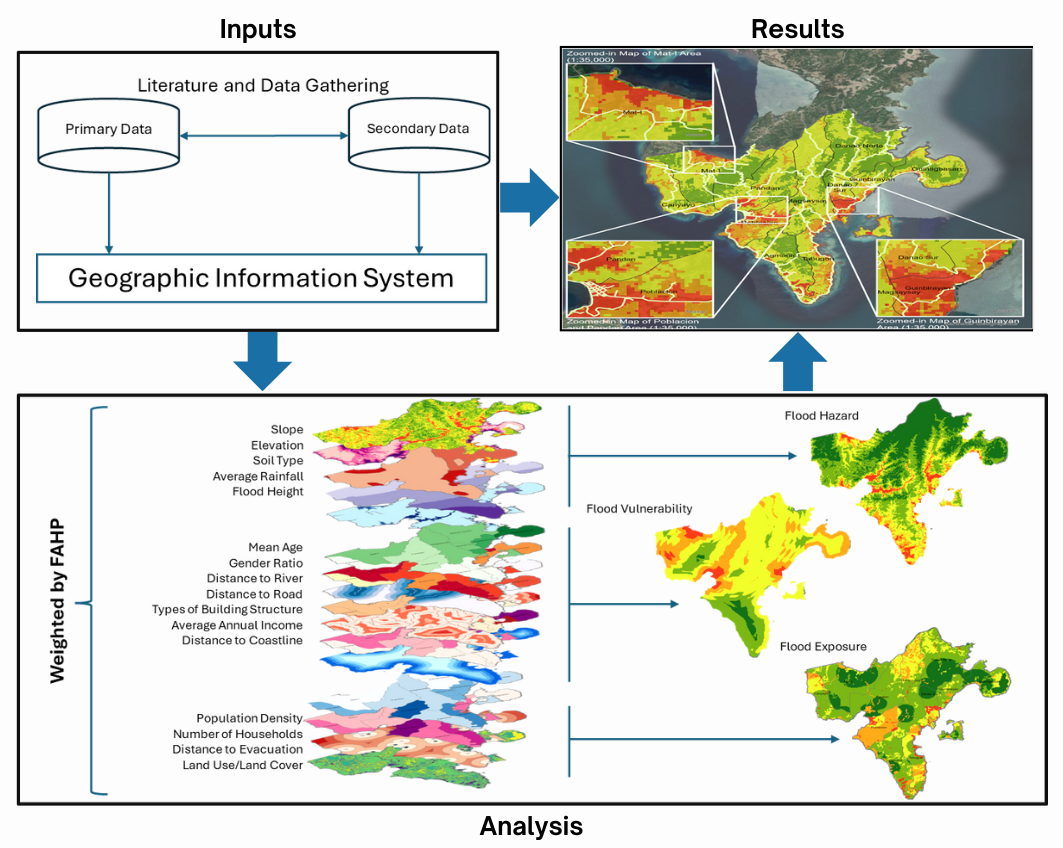
Risk assessment is vital for humanities, especially in assessing natural and manmade hazards. Romblon, an archipelagic province in the Philippines, faces frequent typhoons and heavy rainfall, resulting in floods, with the Municipality of Santa Fe being particularly vulnerable to its severe damage. Thus, this research study intends to evaluate the flood risk of Santa Fe spatially using the fuzzy analytical hierarchy process (FAHP), taking into account data sourced from various government agencies and online databases. GIS was utilized to map flood-prone areas in the municipality. Hazard assessment factors included average annual rainfall, elevation, slope, soil type, and flood height. Distance to river, distance to road, types of building structure, mean age, gender ratio, and average annual income were considered parameters of vulnerability assessment. Exposure assessment considered land use, distance to evacuation facility, household number, and population density. Weights for each parameter were determined through pairwise comparison performed by experts. These weights were then incorporated into risk assessment estimation. The developed risk map identifies five high-risk barangays (small local government units). The study’s findings will enable local government units to establish flood mitigation programs, implement targeted mitigation measures, and formulate strategic response plans to lower risk and safeguard the residents of Santa Fe effectively.Graphic Abstract

Keywords
Cite This Article
 Copyright © 2024 The Author(s). Published by Tech Science Press.
This work is licensed under a Creative Commons Attribution 4.0 International License , which permits unrestricted use, distribution, and reproduction in any medium, provided the original work is properly cited.


 Submit a Paper
 Propose a Special lssue
 View Full Text
 Download PDF
 Downloads
 Citation Tools